
Village of Yellow Springs, Ohio

Building a home, addition, or garage/storage shed? Make sure you’re conforming to your setback requirements
Whether you want to build a shed, detached garage, pool, addition, or an entire new dwelling on a vacant lot, each property belongs to a Zoning District, and with that district comes specific requirements on the size, location, and use of the structure.
To determine the Zoning District your lot is located within, you can use the Greene County Auditor’s GIS map server to locate your lot, and then utilize the “Zoning District” map layer. Or you can click here to see our Zoning District map. You may also contact our office and we’d be happy to look up the zoning for your property.
How to properly calculate your setback.
When planning to build a new structure on your property, you’ll want to determine not only where you want to build on your lot, but you’ll need to make sure that the new structure is not encroaching on your required setbacks.
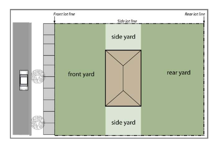
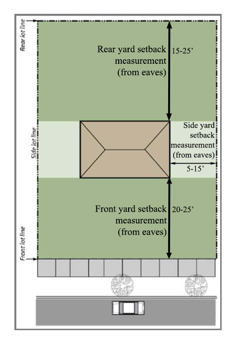
There is a setback requirement for your front, rear and side yards. These yards are defined by the furthest most edge of the structure; the roof line. Take a look at this diagram from the Zoning code, section 1284.11 Definitions: X-Y-Z
Yard. An unoccupied open space from the ground upward, between the building wall and the adjoining lot lines.
(1) Front yard. The space extending the full width of the lot between the nearest edge of a building and the front lot line.
(2) Rear yard. The space extending the full width of the lot between the nearest edge of a building and the rear lot line.
(3) Side yard. An open space extending from the front yard to the rear yard between the nearest edge of a building and the nearest side lot line.
If you plan to have roof eaves or awnings, you must make sure these extensions from the structure fit within your setback. It should not be measured from the building footprint. This is to prevent structures being built that have a roof overhang that extends beyond the footprint and encroaches on neighboring properties.
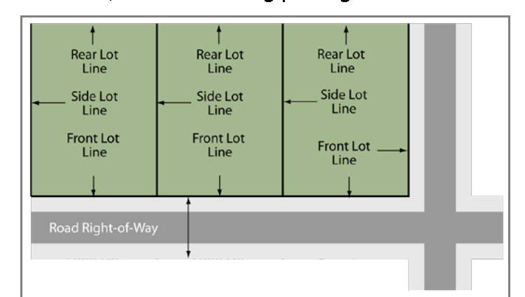
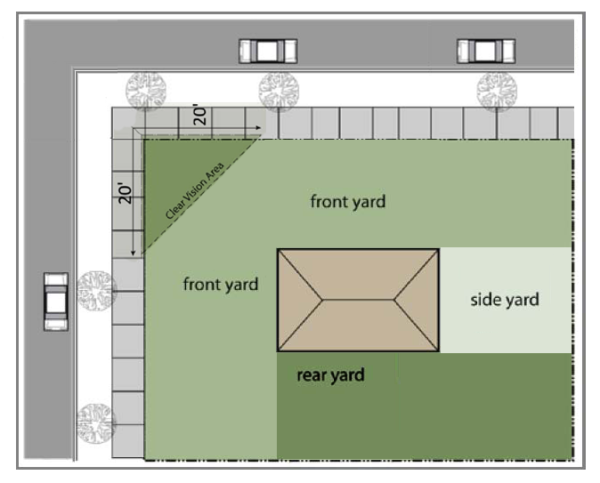
Corner Lots
Corner lots have two front lot lines, one for each right-of-way that the lot abuts. The front yard setback requirements apply for both.
What are “Zoning Districts”, and how to I find out what zone I’m in?
Neighborhoods and blocks are broken down into Zoning Districts based upon the primary use and size of the lots and structures within it.
For example; B-1 Central Business District refers to the Village’s downtown businesses, primarily on Xenia Avenue, Corry and Dayton Streets.
Residential areas are broken into three Zoning Districts, R-A Low density, defined by the large plots and wide distances between each home, intended to accommodate single-family residential subdivision and infill developments at densities of up to six units per acre. R-B Moderate Density defined by the medium sized lots, intended to encompass much of the Village's existing single-family and medium-density residential neighborhoods. R-C High density residential district, is intended to promote a high quality mix of residential units, including multiple-family dwellings, at a density of up to 14 units per acre.
To determine the Zoning District your lot is located on, you can use the Greene County Auditor’s GIS map server to locate your lot, and then utilize the “Zoning District” map layer. Or you can click here to see our Zoning District map. You may also contact our office and we’d be happy to look up the zoning for your property.
To learn more about the Zoning Districts within the Village corporation limit, and the requirements for each, please visit American Legal's online publication of the Zoning Codified Ordinances.
Site Design and Content Copyright © 2015 Village Of Yellow Springs, Ohio
Site Design and Content Management by
Core Business Technologies